a blog of the photos I take, the crap I make and the process of making it
what kind of place is this?
Light rail and train lines and major interchanges. Like many dense cities the regional lines and major stations are on the perfery of the city center, which is served by subway/tram.
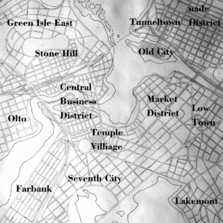
Neighborhood Names
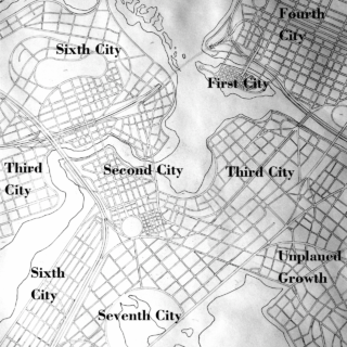
Development occurred in places as government projects referred to as ” City”. This shows those projects general location. (Fifth City is in an area not shown on map.)
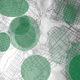
The city is a “gilded” city, with extreme disparities in weath. This map shows areas with above average weath. Darker green = more wealth.
When I finish the roads on a map, I like to “visit” the city. Reading the finished map layout I get a strong feeling of the kind of place it is, its culture and development history. Here are some digital sketchs on top of a picture of my current big city, showing various insights into the kind of city it “really” is.